GIS MAPS BY GUBBI LABS
GIS MAPS depicting the land cover changes in Bangalore over the last 20 years.


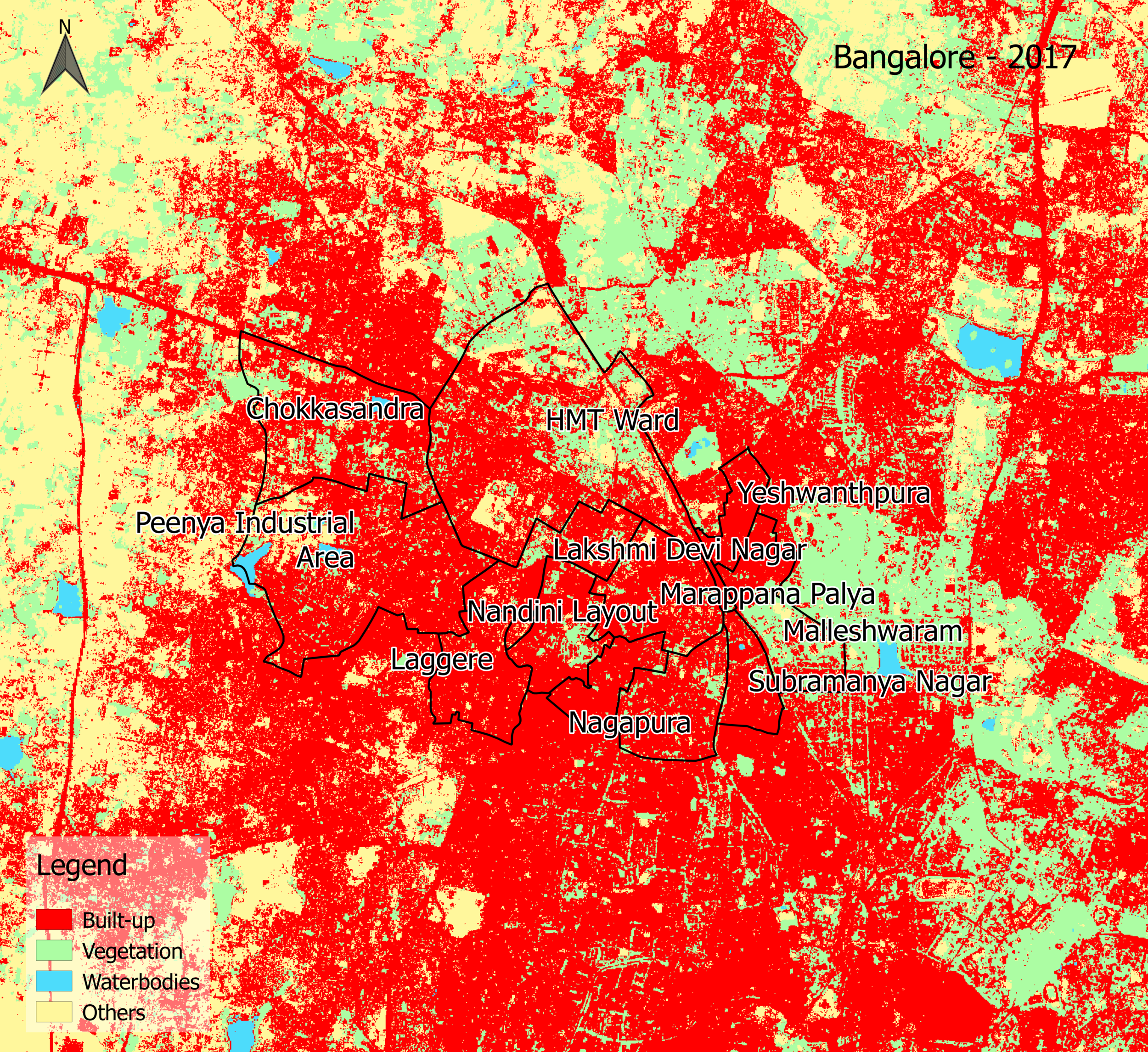
The top row of images shows Bangalore zoomed out, with the whole city and its suburbs in frame— some of its southeastern suburbs are outlined, as are some northwestern neighborhoods. The middle row shows Bangalore’s outlined southeastern suburbs in isolation. The last row shows the outlined northwestern neighborhoods in isolation. Red indicates land that has been built-up; in each row, the amount of built-up land gradually but clearly increases.
JAKARTA’S RAPIDLY EXPANDING BUILT ENVIRONMENT
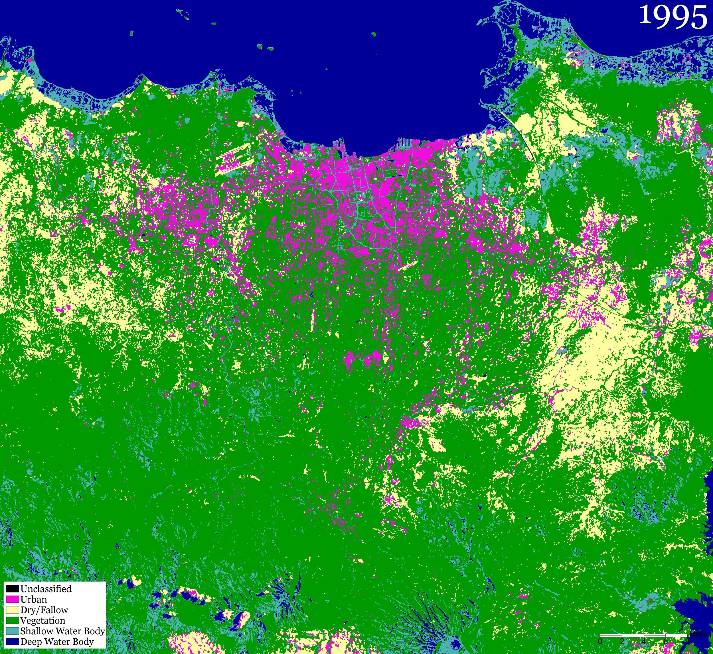
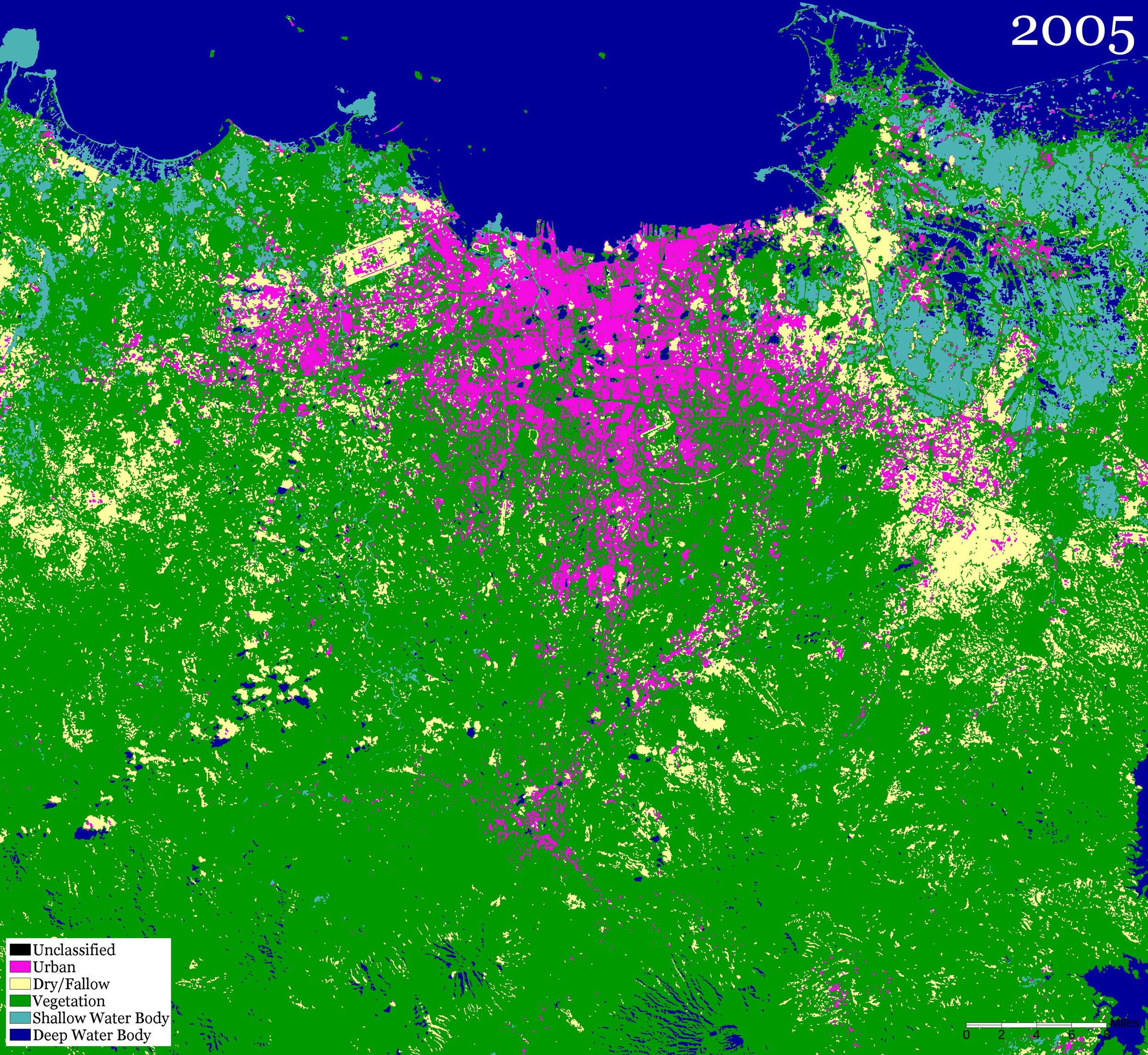
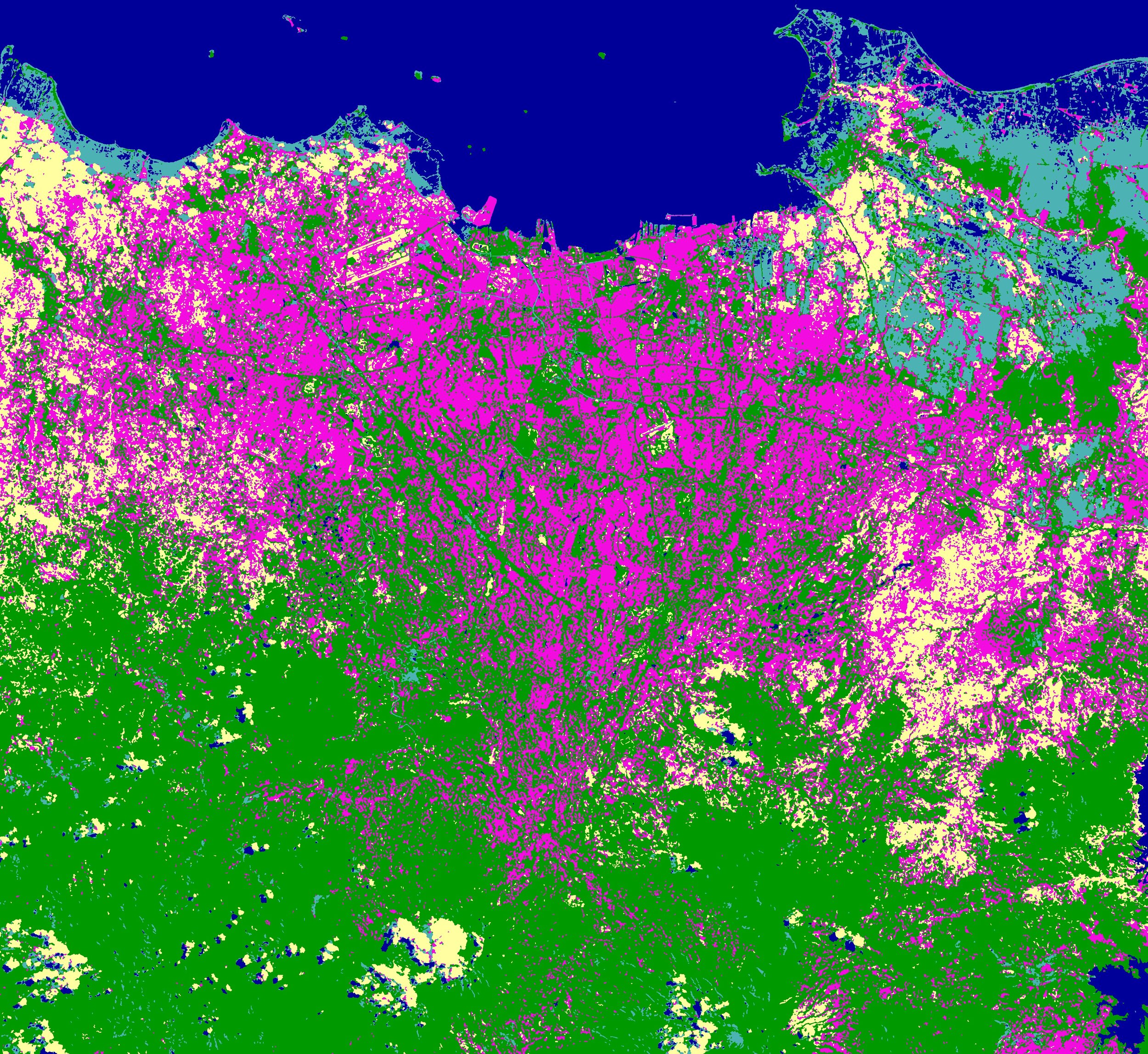
These three images show the spread of the urban built environment (in pink): 1995, 2005, and 2015: Note the remarlable expansion after 2005 as peri-urban Jabodetabek exploded.
Credit: Jessica Standifer, from Landsat remote sensing images